Imagine waking up to a Banana River sunrise and winding down with an Indian River sunset from the same backyard. If that sounds like the waterfront life you want, Merritt Island’s river-to-river homes deserve a close look. You might be weighing views, boat access, privacy, and how these lots really work day to day. In this guide, you’ll learn what makes river-to-river properties unique, how the Indian River and Banana River differ, and the practical steps to shop smart. Let’s dive in.
What “river-to-river” means here
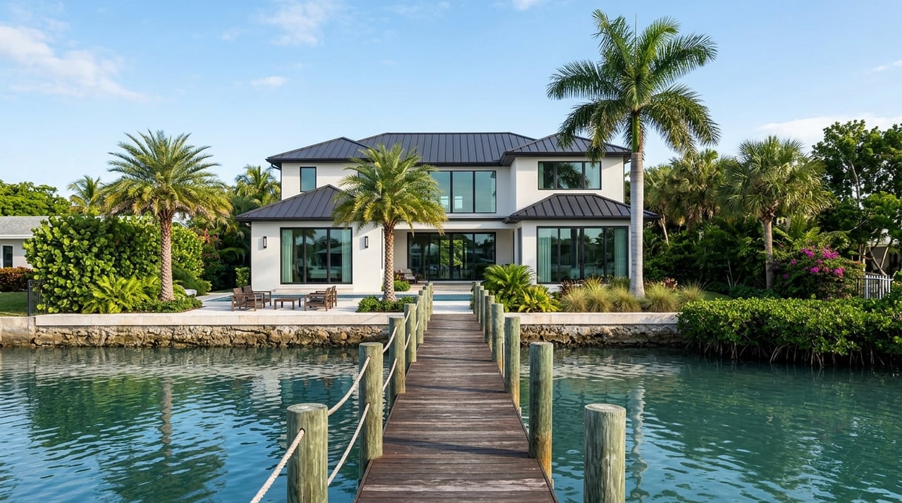
River-to-river lots on Merritt Island are long, narrow parcels that stretch from the Indian River Lagoon on the west to the Banana River on the east. You get frontage on both sides, which can mean two docks, two viewscapes, and very different light throughout the day.
Because Merritt Island sits between two estuarine waterways, each side brings its own character. These lots are a distinct local product of the island’s geography, and they come with special design and permitting considerations. The payoff is rare: dual water exposure, flexible boating options, and a lifestyle that is hard to match.
Indian River vs. Banana River
Indian River: Western exposure
- Orientation: Generally west-facing from Merritt Island, which aligns your living spaces with late-day light and sunsets.
- Water character: Part of the broader Indian River Lagoon system. Some stretches are wide and open, offering broad water views.
- Typical use: Popular for fishing, inshore boating, and enjoying expansive vistas where the lagoon opens up.
Banana River: Eastern exposure
- Orientation: Generally east-facing, which favors sunrise views toward the barrier island and the Atlantic.
- Water character: Often more sheltered in spots because of the barrier island, though local channels and connections near Port Canaveral create variability.
- Typical use: Calmer areas can be great for paddling, wading, and protected boating near residential docks, depending on neighborhood.
Key tradeoffs to weigh
- Sunrise vs. sunset: Banana River sides favor sunrise, Indian River sides favor sunset. River-to-river parcels give you both, though the home’s floor plan will shape which view you enjoy most.
- Exposure and navigation: Some Indian River locations offer wider vistas, while some Banana River segments feel more protected. Actual channel depth, bridge clearance, and ocean access vary by address and should be verified.
- Privacy and activity: One side may sit closer to through-channels, marinas, or roads. Expect privacy and noise levels to vary by micro-location.
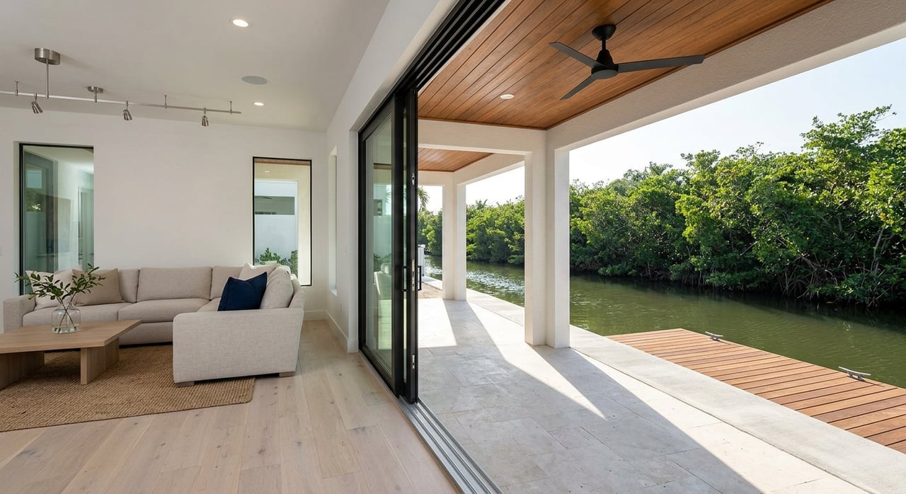
Boating lifestyle and access
Everyday on-the-water fun
Merritt Island residents often enjoy motor boating, sport and flats fishing, kayaking, paddleboarding, and cruising to local marinas. Common boat types include center consoles, bay boats, flats skiffs, and small cabin cruisers. The right vessel for your lot depends on water depth at your dock, the nearby channels, and what your permits allow.
Getting to the ocean
If you plan to run offshore, confirm your route and limitations before you buy. Access depends on whether you have a private dock, the depth alongside it, nearby channel depths, the presence of bridges, and whether those bridges are fixed or movable. Tide range and seasonal shoaling can change conditions. Smart buyers review navigation charts and speak with local marina or harbormaster staff to confirm the path from the lot to the ocean.
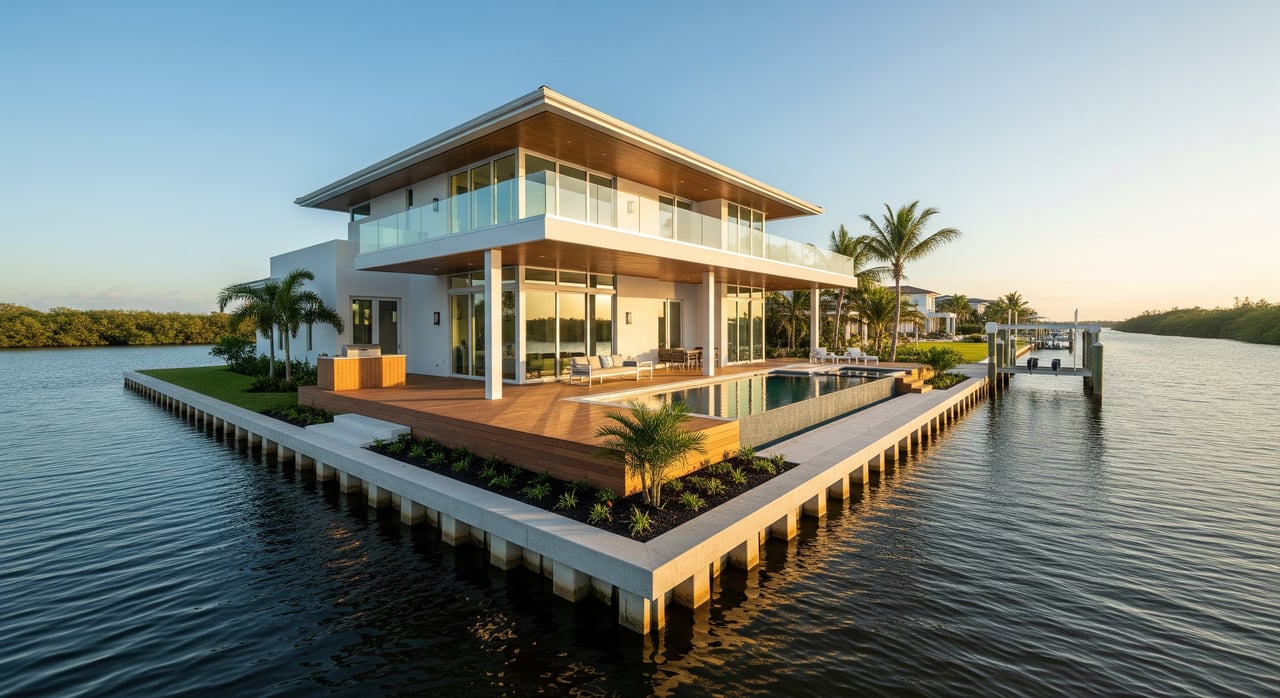
Docks and lifts that matter
The dock setup can make or break daily usability. Look for length that reaches navigable water, a boat lift suited to your craft, solid pilings, and adequate depth at mean low water. Bulkheads or seawalls, adjacent rip-rap, and any community ramps or shared slips also influence convenience and value. Permitting history and capacity for additional slips or lifts can be a premium feature.
Lot and shoreline features that drive value
Shape, frontage, and buildable area
River-to-river parcels are typically deep and narrow. The amount of linear frontage on each side and how much upland is buildable will shape your design options. Larger usable yards and more frontage often command higher values. Vegetation like mangroves, native trees, and marsh can improve privacy and habitat while also influencing views and permitted shoreline work.
Shoreline structures and condition
Existing seawalls, bulkheads, rip-rap, docks, and lifts can add instant utility, but their condition is critical. Replacing or upgrading coastal structures can be complex and costly. Review permits and maintenance history, and assess whether the current layout supports your boating plans.
Utilities and systems
Parts of Merritt Island are on county water and sewer while others may rely on septic or private utility solutions. Power, internet, and drainage availability vary by neighborhood. If you plan a remodel or new build, utility access and connection points are key planning inputs.
Permitting and compliance basics
Shoreline and dock work typically involves local, state, and sometimes federal reviews. Activities like mangrove trimming and shoreline alterations are regulated. Riparian rights, ownership of submerged lands, and the location of the mean high-water line can affect where and how you build a dock.
Before you move ahead with improvements, confirm historic permits attached to the parcel for seawalls, docks, and any fill. Make sure prior work was permitted and remains in good standing. Early conversations with county permitting staff and coastal professionals can save time and reduce risk.
What drives value in river-to-river homes
- Water exposure quality: Open-water, protected channel, marsh-front, or canal settings each carry different appeal and utility.
- Direct navigational access: Shorter runs to channels, adequate depth, and acceptable bridge clearance are major value drivers.
- Frontage and lot size: More linear waterfront and larger buildable upland areas offer flexibility and privacy.
- Dock and bulkhead condition: Turnkey, permitted structures with capacity for slips and lifts can boost value.
- Orientation and light: Sunrise and sunset appeal is lifestyle dependent. Many buyers appreciate having both.
- Privacy and vegetation: Mature buffers can enhance seclusion and reduce line-of-sight to neighbors.
- Nearby services: Proximity to marinas, boat ramps, groceries, and connections to beaches and Port Canaveral add day-to-day convenience.
- Clear paperwork: Properties with clean permits and documented rights for shoreline improvements are typically easier to sell and insure.
Buyer due diligence checklist
- Confirm parcel boundaries, frontage measurements on both rivers, and the mean high-water line with a recent survey.
- Review county parcel records for easements, dock or seawall permits, and any code issues.
- Commission a marine and dock inspection to evaluate seawall or bulkhead condition and measure depth at low tide near the slip area.
- Consult navigation charts and local marinas or harbormasters about channels, bridge clearance, and seasonal shoaling from the lot to the ocean.
- Check with county permitting for mangrove policies, shoreline rules, and the dock permitting process. Review any HOA or neighborhood covenants.
- Verify water, sewer, power, and internet availability, and confirm septic status if applicable.
- Compare recent sales of similar river-to-river properties with comparable frontage, exposure, and dock capabilities.
- Ask a title company to research submerged land ownership, easements, and encumbrances that may affect shoreline use.
- Partner with a waterfront agent and a coastal contractor or engineer for feasibility guidance.
Who to have on your team
- A local waterfront real estate agent experienced with Merritt Island river-to-river properties.
- A licensed surveyor to mark boundaries and the mean high-water line.
- A marine contractor or coastal engineer for dock and bulkhead feasibility.
- A marine or dock inspector to assess structural condition and water depth.
- A title company familiar with coastal parcels and submerged land issues.
- County permitting staff for pre-application guidance.
Is a river-to-river home right for you?
If you want both sunrise and sunset, flexible boating options, and unmatched privacy, river-to-river living on Merritt Island is hard to beat. The best fit comes from matching your boating goals, lighting preferences, and appetite for shoreline stewardship with the right lot and dock setup. With careful due diligence and the right team, you can secure a property that performs for today and holds value tomorrow.
Ready to explore the finest river-to-river homes on Merritt Island or prep your property for a standout sale? Connect with a local specialist who lives and breathes Brevard waterfronts. Reach out to Silvia Mozer to plan your next move.
FAQs
What does “river-to-river” mean on Merritt Island?
- It describes long, narrow lots that span the island from the Indian River Lagoon on the west to the Banana River on the east, often allowing frontage and potential dock sites on both sides.
Which side is better, Indian River or Banana River?
- Each offers different light and water character. Indian River tends to favor sunsets and wide views, while Banana River often offers sunrise and more sheltered areas. The right choice depends on your lifestyle and boating needs.
How do I verify ocean access from a specific property?
- Review navigation charts and speak with local marinas or harbormasters to confirm channel depths, bridge clearance, and routes. Also assess depth at your dock at mean low water.
What should I look for in docks and seawalls during a tour?
- Check dock length, lift capacity, piling condition, and water depth at low tide. Review the condition and permitting history of seawalls, bulkheads, or rip-rap.
Do I need permits to trim mangroves or extend a dock in Brevard County?
- Yes, shoreline work, mangrove trimming, and dock construction are regulated and typically require approvals at the county and state level, and sometimes federal review.
Who are the key professionals for a river-to-river purchase?
- Engage a local waterfront agent, licensed surveyor, marine or dock inspector, marine contractor or coastal engineer, a title company experienced with coastal parcels, and county permitting staff for guidance.