Trying to decide whether North or South Merritt Island fits your lifestyle? You might be weighing commute routes, boating access, or how close you want to be to beaches and daily conveniences. This guide breaks down the practical differences so you can focus your search with confidence. You’ll find clear comparisons, buyer checklists, and tips to tour like a local. Let’s dive in.
How locals draw the line
Locals use landmarks, not strict borders, to define North vs South Merritt Island. Many people refer to areas north of SR 528 or north of SR 520 as “North,” and areas south of those corridors as “South.” Much of the central to northern interior is home to the Merritt Island National Wildlife Refuge, which limits development and shapes where neighborhoods exist.
The island sits between the Indian River Lagoon to the west and the Banana River to the east. A handful of bridges and causeways connect to the mainland and to the barrier islands. Those chokepoints influence daily life. Where you live often determines which bridge you use and how your commute feels during peak hours or special events.
Housing and neighborhood feel
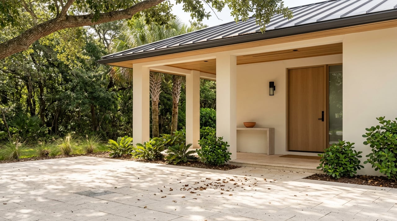
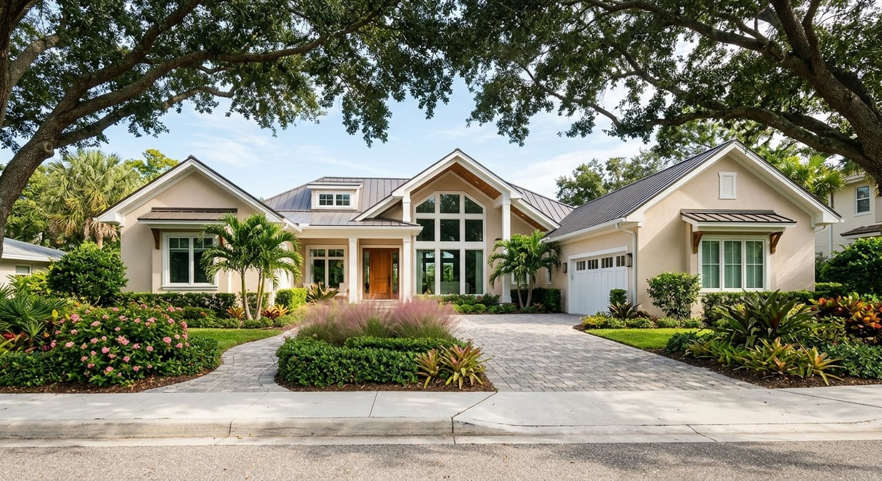
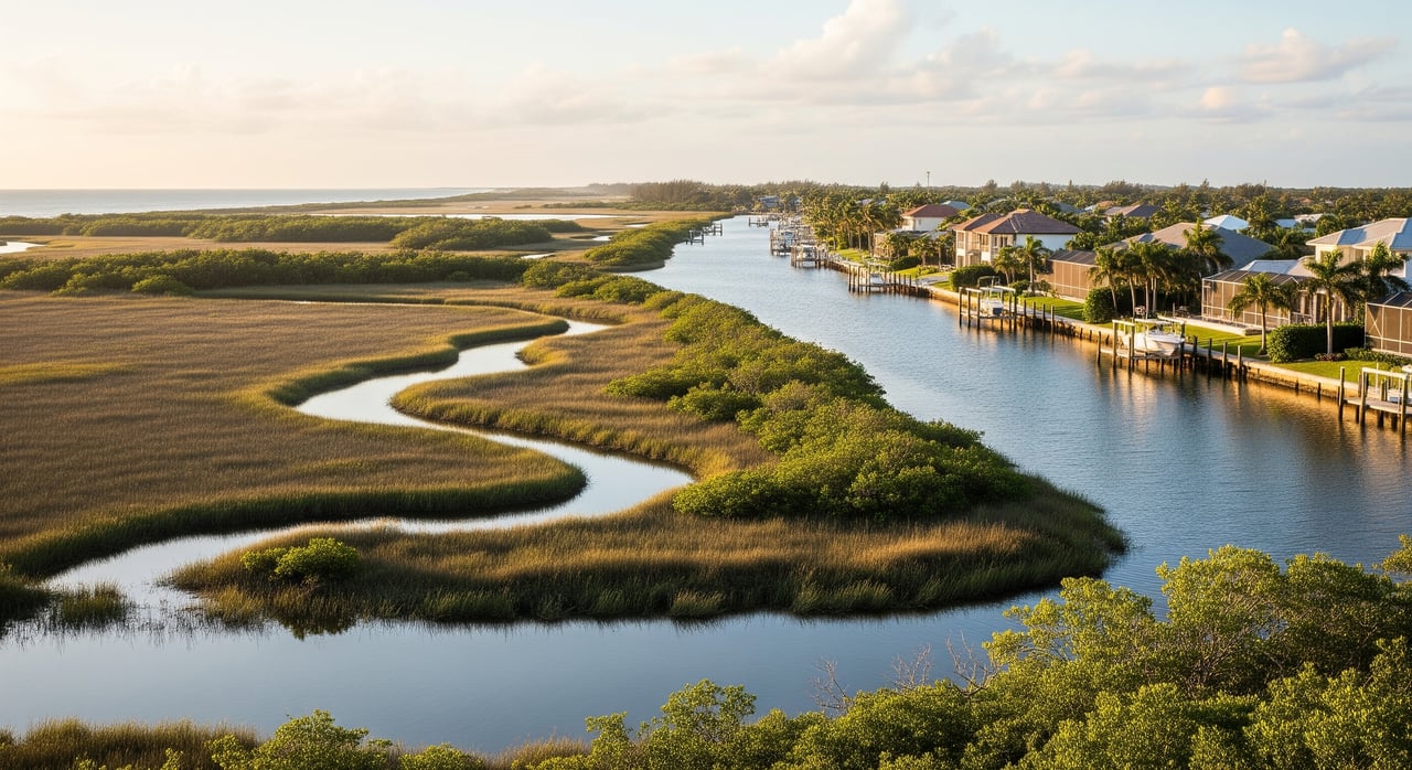
Both sides of the island offer a mix of single‑family homes, canal homes with private docks, modular homes, and some townhomes. You’ll see many mid‑20th‑century ranch styles throughout, along with renovations and select newer builds where redevelopment pencils out near the water. Waterfront and canal properties typically command a premium, with prices and market speed that can differ sharply from non‑waterfront homes.
In general, North Merritt Island includes pockets with larger parcels and older ranch homes closer to Titusville corridors. South Merritt Island tends to have later‑built neighborhoods with smaller lots near Cocoa and Cocoa Beach routes. Canal‑front inventory is often thin across the island, so the exact canal system, depth, and dock rights matter more than simply north vs south.
Quick ways to compare:
- North: Larger-lot pockets, older ranch styles in some areas, closer to refuge lands and Titusville access.
- South: Later subdivisions, smaller lots in many pockets, closer to Cocoa, Cocoa Beach, and Port Canaveral access.
- Entire island: Renovation potential, infill opportunities, and strong value drivers tied to waterfront, canal depth, and dock features.
Commutes and daily routes
Your side of the island often determines which bridge or corridor you use. Launch days, spring break, and cruise traffic can temporarily slow routes, especially around causeways.
North Merritt Island commutes
If you work at Kennedy Space Center or in the Titusville area, North Merritt Island generally offers shorter, more direct drives. Many commuters use US‑1 and northern corridors to reach the mainland. For barrier‑island or beach commutes, plan which causeway you will rely on and test the route during peak times.
South Merritt Island commutes
If your job is in Cocoa, Cocoa Beach, or Port Canaveral, South Merritt Island is often better positioned. You may also find faster routes heading south toward Melbourne-area employers depending on your neighborhood. Expect seasonal traffic upticks near beach corridors and cruise operations.
What to test before you buy
- Drive your work route during a typical rush hour and after a rocket launch window.
- Map your bridge options to the mainland and barrier islands.
- Time access to essentials like grocery stores, gyms, and medical clinics.
Boating and water access
Merritt Island’s canal networks make boating a central part of life. The island borders the Indian River Lagoon and Banana River, with routes that can lead to Port Canaveral and the Atlantic. Your boating goals should guide which neighborhood you target.
North boating profile
Northern areas offer easy access to the Indian River and tidal creeks popular for fishing and wildlife viewing. Some canals here can be shallower or more tidal, which may favor shallow‑draft boats and smaller vessels. Always confirm canal depth at mean low water, especially if you plan to keep a boat at home.
South boating profile
Southern neighborhoods sit closer to the channels that offer shorter runs to Port Canaveral and the Atlantic. If you plan frequent offshore trips or need proximity to ocean marinas and services, South Merritt Island can be a strong match. Bridge clearances and route specifics should be checked for your vessel’s height and draft.
Waterfront property checklist
- Confirm dock and seawall condition and any permits or HOA rules.
- Verify canal depth at mean low water and expected draft limits.
- Check bridge clearances along your route to the inlet or ocean.
- Ask about tidal currents and no‑wake or manatee zones affecting travel times.
- Note access to fuel, repair, and haul‑out services if you run a larger boat.
Amenities and daily living
Southern areas generally offer closer access to Cocoa and Cocoa Beach retail corridors and beach amenities. Northern areas sit closer to Titusville shopping and services. Grocery options exist on both sides, but proximity varies block by block, so it is smart to map your favorites.
The Merritt Island National Wildlife Refuge and county parks deliver hiking, fishing, and wildlife viewing. Public beach access sits across the causeways in Cocoa Beach and Cape Canaveral. Hospital care and major medical services are found on the mainland and in nearby cities, so factor drive times from your specific neighborhood.
Risk, insurance, utilities
Waterfront living brings unique considerations. A careful look at property‑specific details will help you predict costs and long‑term comfort.
Flood and wind factors
- Flood risk varies by block. Obtain a FEMA flood zone check and an elevation certificate when available.
- Ask for recent homeowner and flood insurance quotes early in your process.
- Review hurricane‑ready features like impact windows, roof straps, and updated roofs to understand potential premium savings.
Utilities and HOAs
- Confirm whether the property is on municipal sewer or septic.
- Verify internet and cable options and expected speeds for your address.
- Review HOA or deed restrictions for rules on docks, boat sizes, exterior changes, and rentals.
- Check property tax history and any special assessments through county records.
How to choose your side
Start with your top two lifestyle drivers, then match them to location realities:
- If you work at or near Kennedy Space Center and want a quieter, nature‑forward setting, North Merritt Island may align with your routine.
- If you prioritize ocean access or frequent trips to Cocoa Beach or Port Canaveral, South Merritt Island may fit better.
- If you plan to keep a boat at home, let canal depth, dock rights, and bridge clearances lead your search rather than a simple north vs south label.
- If you love the refuge, fishing, and wildlife, weigh proximity to those access points and tidal conditions.
Before you decide, tour at different times of day, test your commute, visit the marinas you will use, and walk the neighborhood to get a feel for traffic, wind exposure, and sound. The right match comes from aligning your must‑haves with the specific canal system, route, and amenities you will use most.
When you are ready for a curated shortlist and local insight into waterfront micro‑markets, connect with a trusted guide who lives and works this coastline. For tailored touring plans, dock and permit guidance, and calm, detail‑rich representation, reach out to Silvia Mozer. Let’s connect and design a search that fits your lifestyle and timeline.
FAQs
Which side of Merritt Island is better for commuting to Kennedy Space Center?
- If you commute to KSC, North Merritt Island generally offers shorter, more direct routes, but always test your specific drive during peak periods and launch windows.
How does South Merritt Island compare for access to Port Canaveral and Cocoa Beach?
- South Merritt Island often provides quicker access to Port Canaveral and Cocoa Beach amenities, with shorter runs toward ocean routes depending on your neighborhood.
What should boat owners check on Merritt Island canal homes?
- Confirm dock and seawall condition, canal depth at mean low water, bridge clearances, HOA boat rules, and access to marinas, fuel, and repair services.
Are flood and storm risks different between North and South Merritt Island?
- Risk varies by property more than by side; get a flood zone check, elevation certificate, insurance quotes, and review hurricane‑ready features for each home.
How do school options differ across the island?
- Schools are assigned by neighborhood within Brevard County Public Schools; verify attendance zones directly for each address before making a decision.
How seasonal is traffic on Merritt Island?
- Expect heavier traffic near causeways during tourism peaks, spring break, cruise operations, and rocket launches, so plan routes and timing accordingly.
Do HOAs affect dock and rental rules on canal homes?
- Many canal neighborhoods have HOAs that set rules on docks, boat sizes, exterior changes, and rentals; review documents early to avoid surprises.